
Facts About Matanuska Glacier
FACTS ABOUT MATANUSKA GLACIER
Get ready to learn many interesting Matanuska Glacier facts on a guided tour.
Take a guided glacier tour and learn many exciting Matanuska Glacier facts from our knowledgeable and experienced guides. Bonus: they also know where all the best photo ops are along the way. This is a once-in-a-lifetime excursion from the lodge out to the terminus of the Matanuska Glacier.
Matanuska Glacier Facts:
The Matanuska Glacier is a large ice flow, 24 miles long and 4 miles wide at the terminus, averaging approximately 2 miles in width. This glacier is a valley glacier; it exists on a valley floor. Most glaciers in Alaska today are smaller alpine glaciers that hang off mountain slopes.
The Matanuska is an active glacier that advances at one foot per day. The ice takes approximately 250 years to form up-glacier and advance to the terminus. The ice of an active glacier always moves forward due to gravity; like water in a river, the ice will flow down the valley. When ice melts at a higher rate than snow accumulates, the glacier margin ‘recedes’. (The term ‘receding’ does not refer to the ice traveling back up the valley.)
A frequently asked question concerns the cause of the blue ice. The density of glacier ice allows the entire spectrum of light to be absorbed except the blue light, which is reflected and can therefore be seen by your eye.
Glacier Terminology:
Moraine: Debris (including large boulders, gravel, and sand) that has been deposited by the glacier in various ways.

Matanuska Glacier fact: the glacier is 24 miles long and 4 miles wide at the terminus, averaging approximately 2 miles in width.
Lateral: Lining both sides of the glacier, lateral moraines run parallel to ice flow. Lateral moraines are generally created by two processes:
1) a build-up of debris between the sides of the glacier and the bases of surrounding mountains from rock slides off the mountain
slopes and
2) dumping rocks and other debris off the sides of the ice.
Medial: Created as two ice flows merge. As the glaciers meet, a debris pile is pushed up between them. The medial moraine may be recognized as a ‘ribbon’ of black material running down the glacier’s center.
End or Recessional: The glacier’s terminus (or end) is marked by this moraine. Generally lying perpendicular to ice flow, the
end moraine is created as the ice melts and deposits rock and debris.
Vent: An opening in the ice through which water exits the glacier, draining the sub-glacier and en-glacial conduits. The sub-glacial water discharged from these vents is occasionally supercooled (in a liquid state although the temperature is below the freezing point), leading to ‘Vrazil’ ice growth and the formation of terraces and rims surrounding vents.
Basal Ice: The debris-rich ice layer at the bottom of the glacier. This ice is easily visible in several places at the terminus. Most sediment comprising the moraines is first transported in the basal ice.

Matanuska Glacier fact: the glacier is active and it advances at one foot per day.
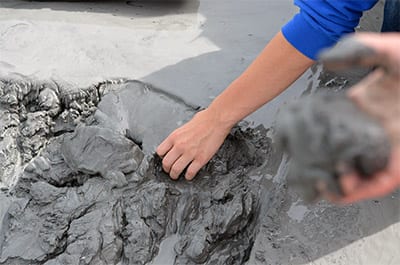
Debris Flow: A small-scale avalanche of rock, debris, and water.
Moulin: A wide vertical shaft connecting the ice surface to the glacial conduit system. Moulins are created by melted water and can be hundreds of feet deep.
Crevasse: A large crack in the ice that may be up to several hundred feet deep and several feet wide, caused by differential speeds in the ice movement.
Serac: Large, towering blocks of ice. Also created by the differential speed in ice movement.